
U.S. Virgin Islands
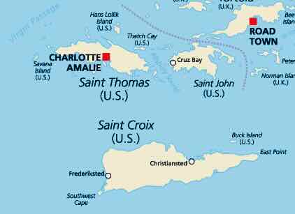
The Virgin Islands of the United States (USVI) are an unincorporated U.S. territory in the Caribbean Sea. They consist of four larger islands: St. Croix, St. Thomas, St. John, and Water Island, as well as several dozen smaller islands. The islands form a combined landmass area of 133.73 mi2 (346.4 km2). [1]
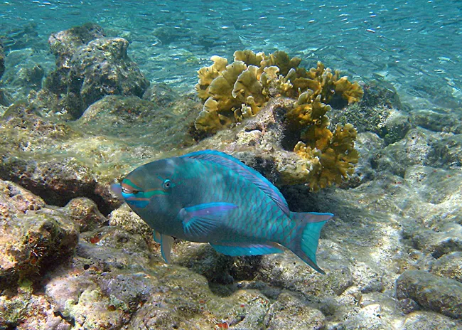
The waters of the USVI host approximately 77 mi2 (200 km2) of coral reefs, including fringing, bank-barrier, and patch reefs. [2]
The reefs of the USVI are home to:
580+ reef fish species [3]
40+ reef-building coral species [2]

Reef Threats


Coral Bleaching
Stony Coral Tissue Loss Disease
Water Quality
Learn more
- The USVI experienced a devastating coral bleaching event in 2023 that lasted longer and was more severe than any bleaching event in USVI history. The corals that survived were hit by severe bleaching again in the summer of 2024. During this bleaching event, water temperatures reached 91.4 degrees Fahrenheit, and some coral nursery outplant sites experienced 100% mortality. [5]
- The Virgin Islands Coral Disturbance Advisory Group (VI CDAC) meets monthly during summer and fall to discuss bleaching threats, monitoring, and communications.
Learn more
- Stony Coral Tissue Loss Disease is a highly contagious coral disease first detected in Florida in 2014. Since then, it has spread throughout the Caribbean. In the USVI, SCTLD was first detected in January 2019 in St. Thomas. [4]
- Since 2019, SCTLD has killed more than half of the living coral at the site it was originally discovered at. It has also spread across the entire USVI. [4]
- In response to this threat, the USVI created an inter-agency group known as the Virgin Islands Coral Disease Advisory Committee (VI-CDAC). This group pursues 4 main goals: reporting and responding to outbreaks, communicating among USVI groups and with neighboring islands, coordinating with experts, and implementing a Coral Disease Outbreak Response Plan. [4]
- View the Coral Disease Outbreak Response Plan
Learn more
- Land-based sources of pollution significantly affect water quality and thus the health of coral reef ecosystems in the USVI. One of the main issues is sediment and silt flowing from the land onto the reef, smothering and sickening corals. Data from the USVI Territorial Coral Reef Monitoring Program (TCRMP) shows that reef sites with the highest silt levels are less healthy than those with lower silt levels. [6]
Reef Protections
- The USVI has 6 marine protected areas (MPAs), including 2 locally-managed MPAs (the St. Croix East End Marine Park and the St. Thomas East End Reserve) and 4 federally-managed MPAs (Buck Island Reef National Monument, Salt River Bay National Historic Park and Ecological Preserve, the Virgin Islands Coral Reef National Monument, and the Virgin Islands National Park).
- The St. Croix East End Marine Park (STEXEEMP) was established in 2003 and was the USVI’s first territorially designated and managed MPA. It includes 4 zones: the Recreation zone, the No-take zone, the Sea turtle reserve, and the Open zone. [7] This MPA encompasses 17 miles of the easternmost part of the island and also hosts a coral nursery, which was installed in 2019. Check out this story map to learn about the park and its unique habitats!
Learn more about USVI MPAs
- The St. Thomas East End Reserve (STEER) encompasses Cas Cay, St. James, and Compass Point Salt Pond. These areas were designated as Marine Reserves and Wildlife Sanctuaries in 1994. An updated STEER Management Plan was published in 2023. [8]
- Buck Island Reef National Monument (BIRNM) was first designated in 1961, then expanded in 2001 to include a total of 19,015 acres. All fishing is prohibited within BIRNM’s boundaries. The National Park Service manages a coral reef conservation program and a long-term sea turtle nesting monitoring program. [9]
- Salt River Bay National Historic Park and Ecological Preserve was designated in 1992 and is managed by the National Park Service. The site has some of the largest remaining mangrove forests in the Virgin Islands and holds archeological significance. [10]
- Virgin Islands Coral Reef National Monument was established in 2001 and consists of 12,708 marine acres. The area is managed by the National Park Service and has limitations on fishing and anchoring within the boundaries. [11]
- Virgin Islands National Park was established in 1956. About ⅔ of the island of St. John is designated as National Park land. The park was designated as an International Biosphere Reserve by UNESCO in 1976. The National Park Service conducts research on seagrass, sea turtles, fish abundance, corals, and archeological history in the park. [12]

Bright Spots and On-Going Initiatives

Coral reef restoration in the USVI began in 2009 when The Nature Conservancy (TNC) established its first nursery on St. Croix. Since then, the USVI’s coral reef restoration efforts have grown. Now, there are 4 in-water and 1 land-based nursery run by TNC, 1 in-water nursery in the East End Marine Park MPA run by the Department of Planning and Natural Resources (DPNR), 3 in-water and 1 land-based nursery run by the University of the Virgin Islands, 1 in-water nursery run by the Coral Restoration Foundation (CRF), 1 in-water nursery run by Thriving Islands, 1 in-water nursery run by Caribbean Oceanic Restoration and Education Foundation (CORE), and 1 in-water and 1 land-based nursery run by Coral World Ocean and Reef Initiative (CWORI). [13][14][15]
Learn more about reef restoration in the USVI
- In July 2023, the USVI published the territory’s first-ever Coral Reef Restoration Plan to guide reef restoration planning for the next 10 years. Check out the Restoration Plan.
- The Virgin Islands Restoration of Coral Squad (VIRoCS) meets monthly to discuss progress towards restoration plan goals and collaborate on learning exchanges, permits, workshops, and more. VIRoCS is currently working on fine-tuning an online map for the territory to showcase restoration efforts. Check out the first draft of the map.

In summer 2024, the USVI held its first-ever Coral Reef Week to promote community outreach and engagement with local coral reefs. This event consisted of 11 free outreach events, such as snorkel clinics and art shows, and engaged over 650 residents in marine conservation. The second annual Coral Reef Week was held in April 2025 in St. Thomas and consisted of 14 free outreach events such as school trips, kayaking tours, Reef Fest, a student art show, and more. Over 950 Virgin Islanders were engaged in the events in 2025. [16] Planning for Coral Reef Week 2026 on St. Croix is underway!

In 2024, the USVI’s Salt River Bay National Historical Site and Ecological Preserve was officially designated as a priority watershed for the Watershed Partnership Initiative. The Watershed Partnership Initiative enhances coordination, partnerships, and contributions from U.S. Coral Reef Task Force agencies and jurisdictions to implement activities that reduce land-based sources of pollution from entering coral reefs.

The USVI’s Territorial Coral Reef Monitoring Program (TCRMP) has been monitoring local reefs and conducting underwater surveys since 2001. Data collected from years of surveying helps to monitor the long-term health of the USVI’s reefs, and helps scientists link changes in reef health with specific local threats. Check out TCRMP’s website
The reefs of the USVI are managed by the USVI Department of Planning and Natural Resources (DPNR) through their Coral Reef Initiative. DPNR works in collaboration with many stakeholders and restoration practitioners such as NGOs, federal agencies, universities, and local businesses.
Check out USVI Department of Planning and Natural Resources website to learn more about their work!
Connect with DPNR on social media @dpnr.vi
Connect with the coral reef restoration practitioners in the USVI:
- The Virgin Islands Coral Reef Advisory Group – @vi.crag
- The Nature Conservancy – @nature_caribbean
- The Friends of the St. Croix East End Marine Park – @friends.stxeemp
- University of the Virgin Islands – @reef_response
- Thriving Islands/Featherleaf Inn – @featherleafinn
- CEIBA Strategies – @ceibastrategies
- Caribbean Oceanic Restoration and Education Foundation – @coreusvi
- Coral Restoration Foundation – @coralrestorationfoundation
- National Park Service – @buckisland_nps and @virginislandsnps
- Coral World Ocean and Reef Initiative – @cwori_vi
- NOAA Coral Reef Conservation Program – @noaacora


Other resources to explore
- Friends of the St. Croix East End Marine Park
- Thriving Islands
- The Nature Conservancy
- University of the Virgin Islands
- University of the Virgin Islands Coral Reef Health Lab
- CEIBA Strategies
- Caribbean Oceanic Restoration and Education Foundation
- Coral Restoration Foundation
- National Park Service USVI Parks
- Coral World Ocean and Reef Initiative
- NOAA Coral Reef Conservation Program
Sources cited
- [1] University of the Virgin Islands’ United States Virgin Islands Information
- [2]Ecology of Coral Reefs in the US Virgin Islands
- [3] An updated, illustrated inventory of the marine fishes of the US Virgin Islands
- [4] Stony coral tissue loss disease in the U.S. Virgin Islands
- [5] The 2024 Coral Bleaching Event: How the Territory Responded and How You Can Help
- [6] Land-based Pollution
- [7] St. Thomas East End Reserves
- [8] St. Thomas East End Reserves (STEER) Management Plan
- [9] Buck Island Reef
- [10] Salt River Bay National Historical Park and Ecological Preserve
- [11] NPS Virgin Islands Coral Reefs
- [12] NPS Virgin Islands
- [13] U.S. Virgin Islands Coral Reef Restoration Plan
- [14]CRF launches new satellite program in St. Croix, USVI
- [15]https://coralrestoration.org/crf-launches-new-satellite-program-in-st-croix-usvi/
- [16] USVI Coral Reef Week